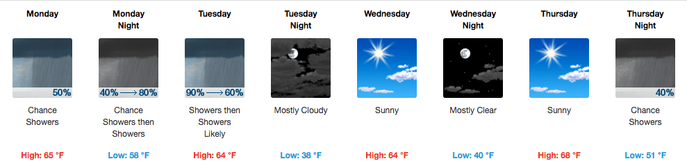
Summary: Rain for Monday and Tuesday, slight break in the rain for Wednesday and Thursday before rain chances set in again. No forecasted severe weather.
Rain setting in for the week, but so far no forecasted severe weather.
Monday – High 65* Low 58*
Today, we have a 50% chance of showers, with a high temperature around 65. Winds will be out of the south at 10 to 15mph, with gusts as high as 25mph. Rain totals around a tenth to a quarter of an inch.
Overnight, rain chances increase to 80% where we may have some thunderstorms. So far they seem to be tame storms. Overnight low should drop to around 58 degrees. Winds out of the south at 15 to 20mph, with gusts as high as 35mph.
Tuesday – High 64* Low 36*
Chance of rain around 90% with showers and a possible thunderstorm. High temperature around 64 degrees. Winds from the south at 5 to 15mph, with gusts as high as 30mph.
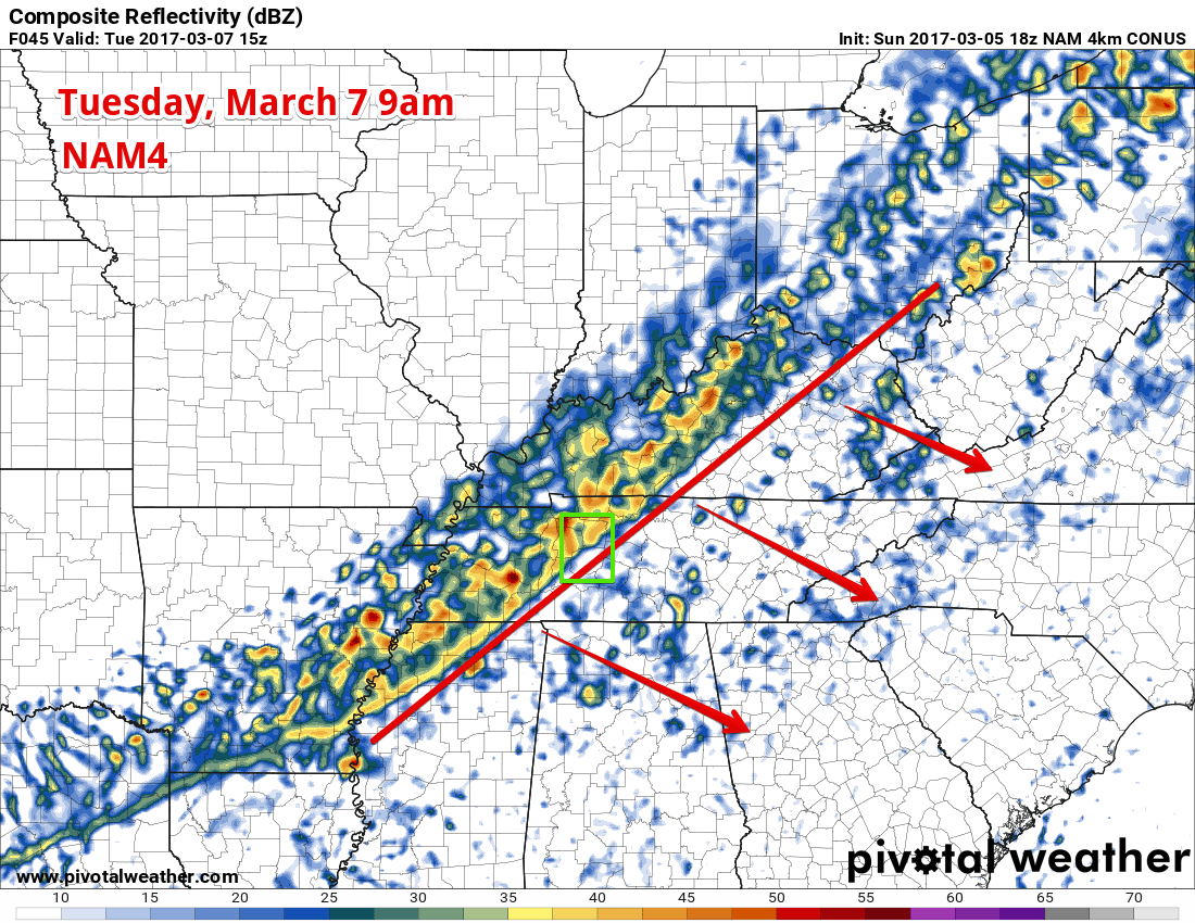
Early on Tuesday morning, cold front will move in, and ahead of the cold front will be some showers and storms. We don’t anticipate these being nearly as rough as the March 1st storms, but they will be breezy, wet, and possibly a bit thunderous.
Here’s the NAM4 simulated radar far Tuesday morning, 9am, showing the line of storms on top of us.
Overnight, rain chances decrease and bring in mostly cloudy skies. Low temperature around 38. Winds shift to be out of the west at around 5mph.
Wednesday – High 64* Low 40*
Sunny skies on Wednesday with no chance of rain. High around 64 degrees with winds out of the west at 5 to 10mph.
Overnight, skies are lear with a low around 40. Winds remain out of the west at 5mph, calming after midnight.
Extended Forecast